Minehead → South Haven Point · 630 miles
Walk the South West Coast Path
England's longest National Trail — 630 miles of cliffs, coves and beaches from Minehead in Somerset, around Devon and Cornwall, to South Haven Point in Dorset.

Plan My South West Coast Path
One form. Tours, guides, stays, transfers, buddies — matched in seconds.
England's greatest coastal walk
The South West Coast Path is England's longest National Trail — 630 miles (1,014 km) tracing the entire peninsula from Minehead in Somerset, around the coasts of Devon and Cornwall, to South Haven Point on Poole Harbour in Dorset. It began as the paths walked by coastguards patrolling the cliffs for smugglers, and was completed as a National Trail in 1978. You set out over the Exmoor cliffs, follow the surf coast of Cornwall past Land's End and the Lizard, and finish 630 miles later along the Jurassic Coast.
This is an independent guide and app to help you plan and walk it: every stage broken down, the history and wildlife along the route, and offline maps in your pocket. Walk it self-guided, or arrange baggage transfer and carry only a day pack.
The whole path, on one map
All 52 stages from Minehead round to South Haven Point — tap a stage to open its guide.
The route, in four parts
From the Exmoor cliffs to the Jurassic Coast — see the full 52-stage guide.


Walking one region at a time? Each has its own guide, with every stage, its distance, its climb and its grade.
🎧 The Audio Guide Library
630 miles of coast, with the stories switched on
An audio guide at every heritage site on the Path — castles, engine houses, lighthouses and quarries. Free to read here; narrated in the free app and triggered by GPS as you walk up to them. The narration is in the app only.
Every site with an audio guide — all 47, by name
- Minehead & the Start Sculpture
- Culbone Church
- Valley of Rocks
- Ilfracombe Harbour & Verity
- Braunton Burrows
- Appledore
- Clovelly
- Hartland Quay
- Tintagel Castle
- Tintagel Old Post Office
- Padstow & Prideaux Place
- Port Isaac
- Bedruthan Steps
- Wheal Coates & St Agnes Mining Coast
- Godrevy Lighthouse
- St Ives
- Geevor Tin Mine & Pendeen Watch
- Botallack & Levant Mines
- Cape Cornwall
- Land's End
- Minack Theatre & Porthcurno
- St Michael's Mount
- Lizard Point
- Trebah & Glendurgan Gardens
- St Anthony Head & the Roseland
- Charlestown Harbour
- Fowey
- Looe & Looe Island
- Rame Head Chapel
- Plymouth Hoe & the Barbican
- Burgh Island
- Salcombe & Overbeck's
- Dartmouth & Dartmouth Castle
- Slapton Sands & Ley
- Berry Head
- Exmouth & the Exe Estuary
- Beer & the Quarry Caves
- Lyme Regis & The Cobb
- Abbotsbury & the Swannery
- Golden Cap
- Portland Bill & the Quarries
- Durdle Door & Lulworth Cove
- St Aldhelm's Head Chapel
- Tyneham Ghost Village
- Corfe Castle
- Old Harry Rocks
- South Haven Point - The Finish
630 miles around the South West coast
England's longest National Trail · Minehead → South Haven Point
From hikers on the trail
Latest photos from the trail
Taken on the path and shared from the app, stage by stage. Add yours from the app camera.
Free · No account · Two minutes
So how well do you actually know the South West Coast Path?
Quizzes on the history, wildlife and landscape you walk through. Ten questions each — get your score, then send it to whoever swears they know better.
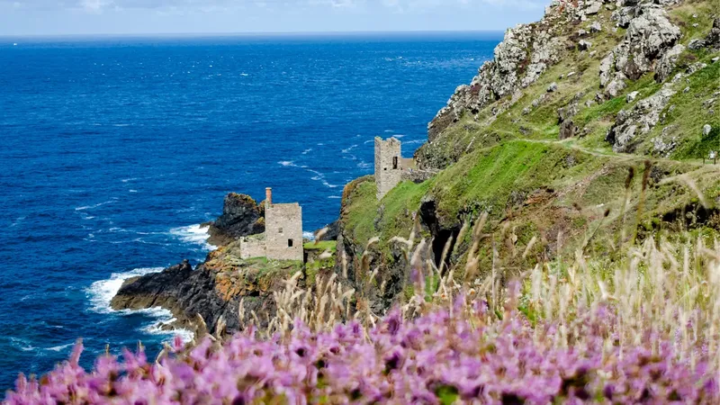 Cornwall
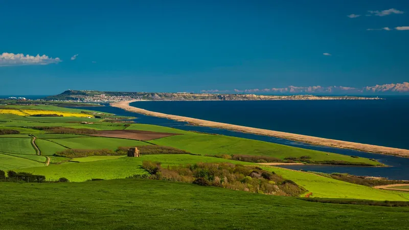 The Jurassic Coast
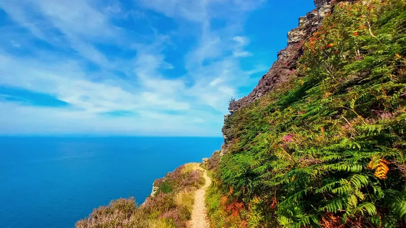 The South West Coast Path
Everything you need on the trail
The free South West Coast Path app turns your phone into a guide that works with no signal.

Offline GPS maps
Download each stage and navigate with full GPS even where there's no signal — along every cliff and cove.
Heritage audio guides
Listen to the story of the route — Tintagel, the Minack Theatre, St Michael's Mount, Durdle Door and more — as you reach each site.
Progress tracking
Tick off stages, log your hikes, and watch your progress build all the way from Minehead to South Haven Point.
Daily safety check-in
Share your plan with an emergency contact and check in each day — peace of mind on the remote clifftop stages.
Find a walking partner
The buddy finder helps you meet other walkers heading the same way on your dates.
Plan & pack
Build a day-by-day itinerary, get a kit checklist, and see what's at each overnight stop.
Scenes from the trail
A taste of the 630 miles — Exmoor cliffs, Cornish coves, the Lizard and the Jurassic Coast.


Plan your South West Coast Path walk
Which section, how many days, when to go — answered from the stage data.
Frequently asked questions
How long does the South West Coast Path take to walk?
Walking the full 630-mile (1,014 km) route typically takes 7 to 8 weeks. It is usually split into 52 official day-stages, so many walkers tackle it in sections over several trips.
Which direction should I walk it?
Most walkers go anti-clockwise, starting at Minehead in Somerset and finishing at South Haven Point in Dorset, so the steeper climbs are tackled early and the going eases towards the end.
When is the best time to walk the South West Coast Path?
April to October is the best season, with the longest days and most settled weather. High summer brings the busiest paths, while spring and autumn are quieter on the coast.
Is the South West Coast Path a National Trail?
Yes — the South West Coast Path is England's longest National Trail, completed in 1978. It is waymarked with the National Trail acorn symbol throughout.
Do I need a guide?
No. The route is well-waymarked and our free app gives you offline maps and GPS for every stage. Many walkers use a baggage-transfer service so they only carry a day pack.
How much climbing is there on the South West Coast Path?
A great deal — the ascent, not the distance, is what makes this trail hard, because the path drops to sea level at every cove and river mouth and climbs straight back out. Measured along the mapped route, the 52 stages here come to roughly 24,500 m of climbing in total; published figures for the whole path vary, since the answer depends on how finely the route is sampled and where the ascent is aggregated. The comparison that holds either way is between days: the hardest single stage for climbing is Lynmouth to Combe Martin (Stage 3) at about 908 m. Every stage guide on this site shows its own elevation profile and its own total climb.
Are there ferries on the South West Coast Path?
Yes — 16 of them, plus one river with no boat at all. The ferries are part of the official route because the south coast is a chain of drowned river valleys with no bridge near the sea. 8 run year-round and the rest are seasonal, so a walk planned for early spring or late autumn needs checking. The River Erme on Stage 37 is waded at low tide.
Which section of the South West Coast Path should I walk first?
It depends on what you want. Cornwall is half the trail and has the most famous scenery; Dorset and the Jurassic Coast is the shortest full section and the easiest to reach from London; North Devon has the hardest climbing on the whole path. Each region has its own guide here with every stage, its distance, its climb and its grade.
Do I have to walk the whole 630 miles?
No, and most people do not. Walking it in sections over several years is the normal way to do this trail rather than the exception — the path passes through resort towns and fishing villages for its whole length, so public transport back to a base is usually available.
Ready to walk the coast?
Start with the stage-by-stage guide, then take the app with you on the trail.